Photos by Jack Waldron

Like many ancient pagan locations, which were appreciated for aesthetic qualities that allowed a glimpse beyond the self, here, on the site of a pagan temple, situated at the extreme end of the plateau (pictured above), there sits a chapel known as the Kiz Kilise (about three stories high, to put it in perspective). Beyond the river known as the Arpa Cayi, sits Armenia. Both the chapel (pictured above) and the citadel of the city of Ani (located behind me in this photo), are believed to anti-date the Bagratid dynasty. Use the map below to locate the Kiz Kilise chapel site (bottom/south), and then, the entrance to Ani (top/north), and follow the photographs from there, along the east side of the site.


Pictured from outside the city, the great double wall with massive towers stretches from the Alaca Cay river ravine in the north west to the Arpa Cayi river ravine in the south east: Ani occupies a triangular plateau with natural protection beyond the great wall. Below, the main entrance to Ani, known as the Arslan Kapisi, or Lions Gate.


Above, one of a number of gates into the city along the great wall (pictured below from the inside).


As one walks east along the great wall, you come to what remains of the 11C AD Holy Redeemer, which according to an inscription within, once housed a fragment of the True Cross brought from Constantinople. The interior is decorated with frescoes from the period.


The church pictured above and below, was dedicated to St. Gregory the Illuminator, and is spectacularly perched on the edge of precipice above the Arpa Cayi. According to an inscription on the building, the church was founded by a merchant called Tigran Honents, who hoped that it would bring good fortune to his family and the rulers of Ani.

Pictured below are the deteriorating frescoes that depict the Ascension of Christ on the dome, the life of Christ and the Blessed Virgin, and various violent acts carried out in one name or another, depicting beheadings and being hung from ones feet until death.


The decorations and inscriptions on the outside of the church are absolutely exquisite.

Pictured below, looking out to the outer edges of the plateau, where the two ravines meet: the church of Tigran Honents is to my back, the great wall is to my right (not pictured), and there in the far right of the picture sits the 10C AD Church of the Holy Apostles, also known as the Great Cathedral.

Pictured center right is the 11C AD Ulu Cami (Amenian council chamber), converted to a Mosque in 1072 AD, and also known to have played the role of checkpoint along this section of the silk road. Finally, in the distant left, sits the citadel, surrounded and protected by the deep ravines (on the extreme point of which, sits the Kiz Kilise).

Pictured above and below, the 10C AD Church of the Holy Apostles, founded by the Pahlavuni family, and the possible seat of the Archbishop of Ani.

Begun in 989 AD, and completed in 1001 AD, the Great Cathedral was dedicated to the Blessed Virgin.

Above, some of the cathedral decoration, below, the columns and missing dome.


Looking back from where I came, pictured in the foreground, the Ulu Cami, and behind it, the Great Cathedral. Pictured below, the inside of the Ulu Cami (Amenian council chamber), converted to a Mosque in 1072 AD, also played the role of checkpoint along the silk road.

Pictured below, the outside of the Ulu Cami, showing the intricate stone work and design, and the sizable minaret (both covered with modern protective roofs).

Pictured below, with Armenia on the right side of the river (east), and Turkey (Ani) on the left (west), there, deep in the ravine, on either side of the Arpa Cayi river, the base mounts of the ancient silk road bridge, that once connected the far east with the east. Pictured left, the Ulu Cami, left center, the Great Cathedral, and far center, the Church of the Holy Redeemer.


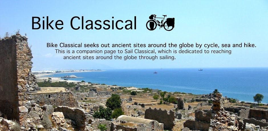
In the foreground of the picture above sits the lowly Church of the Shepard, with the Kiz Kilise pictured far out on the point of the triangle shaped plateau, left of photo. Below, the protective wall of the citadel, with the Alaca Cay river below.
Pictured above, the protective wall of the citadel, with the Alaca Cay river below, and Armenia on the other side.

The Kiz Kilise pictured through a ruin with no name (pictured above and below).

The trail to Kiz Kilise is an intriguing one, and I would have ventured out to the cathedral, however, I was warned at the site entrance gate that the area was off limits due to its proximity to Armenia.

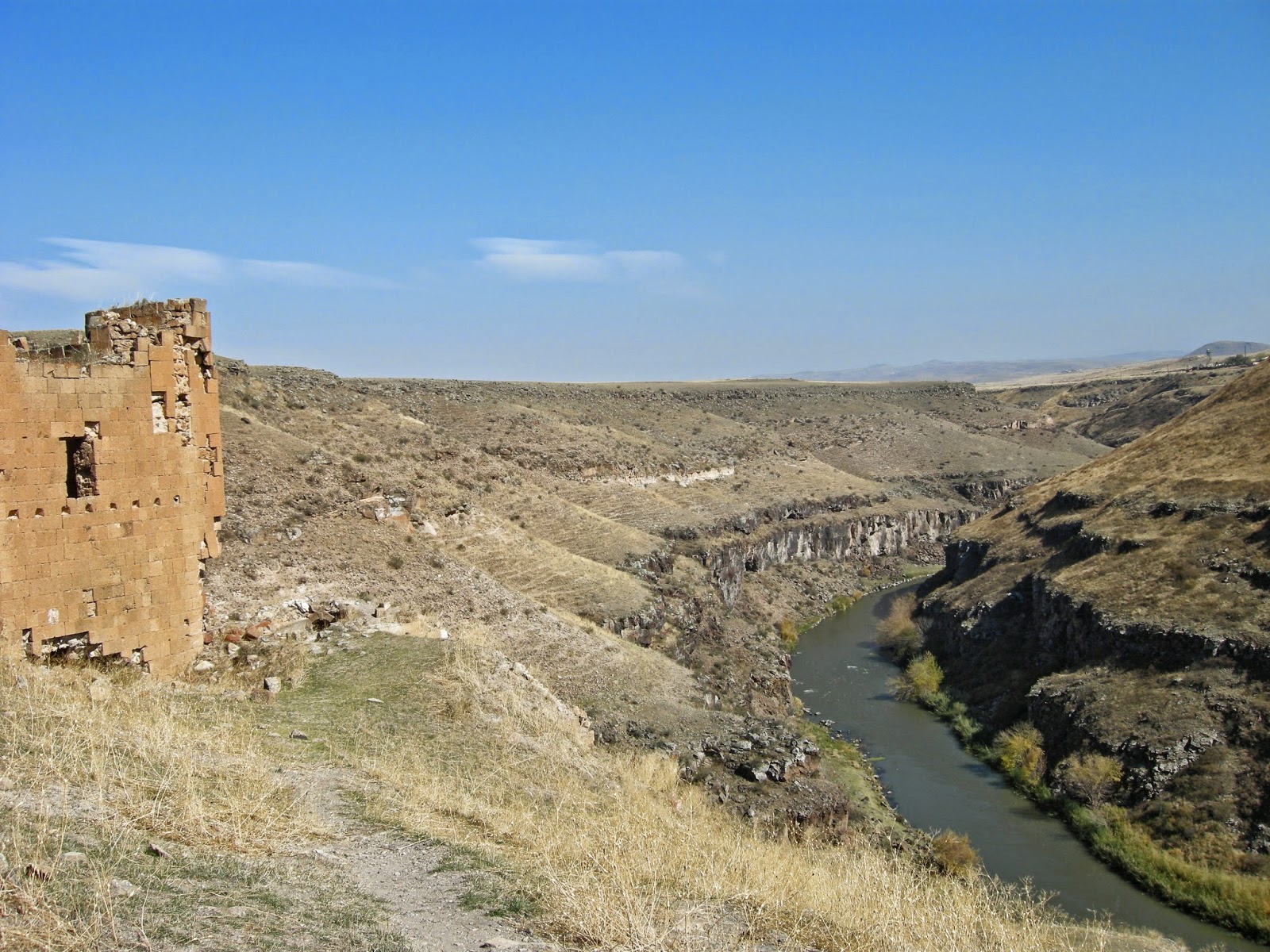
Above, ancient cliff dwelling above the Alaca Cay river valley, with the city wall running behind.

Though in ruin, the inside of this 13C AD Georgian church (later converted into a mosque) displays magnificent stone design and decoration.

The entrance (pictured below) also displays finely detailed ornamentation, while the east side has a number of inscriptions in ancient Georgian, now vanished.

Pictured below is the well preserved 9C AD Church of St. Gregory of the Abumarents family, situated just above the cliff dwellings along the Alaca Cay river.

Ancient Armenian script adorns the entrance (pictured below).


Pictured above and below, what remains of the grand Church of St. Gregory the Illuminator (one of three churches at Ani, which were dedicated to him).


*All photos and content property of Jack Waldron (photos may not be used without written permission)
**If you'd like to help with future postings, please feel free to support them through PATREON: